Property Record
600 Progress Rd, Dayton, OH 45449
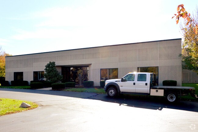


Property Detail
600 Progress Rd
Dayton, OH
2258 PT ABATEMENT
K48-00417-0023
Montgomery
Lightindustrial
Ohio
B and X Area of moderate flood hazard, usually the area between the limits of the 100-year and 500-year floods.
23
2024
7.46 AC
2025
South Dayton
050303
Cincinnati/Dayton
19,640 SF
NEARBY LISTINGS FOR SALE OR LEASE
DEMOGRAPHICS near 600 Progress Rd
1 mile
3 mile
5 mile
2025 Total Population
10,924
57,125
117,814
2030 Population
10,741
56,373
116,370
Pop Growth 2025-2030
(1.68%)
(1.32%)
(1.23%)
Average Age
41
42
42
2025 Total Households
5,087
25,485
51,526
HH Growth 2025-2030
(1.65%)
(1.26%)
(1.22%)
Median Household Inc
$60,691
$69,077
$75,775
Avg Household Size
2.10
2.20
2.20
2025 Avg HH Vehicles
2.00
2.00
2.00
Median Home Value
$173,345
$211,367
$245,822
Median Year Built
1975
1973
1973
Nearby Places
Map Layers
Map Styles
 Street
 Aerial
Transit
 Traffic
 Biking
Places
Listings with unknown addresses are not visible on the map
- Restaurants
- Banks
- Shops
- Fitness
- Groceries
PUBLIC TRANSPORTATION
AIRPORT
James M Cox Dayton International
Drive
Walk
Distance
James M Cox Dayton International
34 min
21.5 mi
Nearby Properties
Address
Land Use
TOTAL SIZE
Lot Size
Zoning
Address
Land Use
TOTAL SIZE
Lot Size
Zoning
104,705 SF
36.80 AC
Address
Land Use
TOTAL SIZE
Lot Size
Zoning
25,715 SF
23.28 AC
Address
Land Use
TOTAL SIZE
Lot Size
Zoning
1,042,121 SF
51.37 AC
Address
Land Use
TOTAL SIZE
Lot Size
Zoning
640,970 SF
94.06 AC
Address
Land Use
TOTAL SIZE
Lot Size
Zoning
Address
Land Use
TOTAL SIZE
Lot Size
Zoning
47,552 SF
47.55 AC
Address
Land Use
TOTAL SIZE
Lot Size
Zoning
6,204 SF
19.27 AC
Address
Land Use
TOTAL SIZE
Lot Size
Zoning
2,304 SF
45.55 AC
Address
Land Use
TOTAL SIZE
Lot Size
Zoning
318,347 SF
26.75 AC
Address
Land Use
TOTAL SIZE
Lot Size
Zoning
145,322 SF
22.31 AC
Address
Land Use
TOTAL SIZE
Lot Size
Zoning
129,932 SF
25.84 AC
Address
Land Use
TOTAL SIZE
Lot Size
Zoning
71,204 SF
5.15 AC
Address
Land Use
TOTAL SIZE
Lot Size
Zoning
66.56 AC
Address
Land Use
TOTAL SIZE
Lot Size
Zoning
1,042,121 SF
51.37 AC
Address
Land Use
TOTAL SIZE
Lot Size
Zoning
131,742 SF
7.75 AC
Address
Land Use
TOTAL SIZE
Lot Size
Zoning
89,683 SF
33.45 AC
Address
Land Use
TOTAL SIZE
Lot Size
Zoning
138,484 SF
23.04 AC
Address
Land Use
TOTAL SIZE
Lot Size
Zoning
24,928 SF
13.67 AC
Address
Land Use
TOTAL SIZE
Lot Size
Zoning
175,268 SF
14.03 AC
Address
Land Use
TOTAL SIZE
Lot Size
Zoning
64,364 SF
26.01 AC
Address
Land Use
TOTAL SIZE
Lot Size
Zoning
155,702 SF
5.95 AC
Address
Land Use
TOTAL SIZE
Lot Size
Zoning
31.95 AC
Address
Land Use
TOTAL SIZE
Lot Size
Zoning
414,124 SF
14.98 AC
Address
Land Use
TOTAL SIZE
Lot Size
Zoning
90,769 SF
1.05 AC
Address
Land Use
TOTAL SIZE
Lot Size
Zoning
70,234 SF
11.22 AC
Address
Land Use
TOTAL SIZE
Lot Size
Zoning
82,510 SF
12.79 AC
Address
Land Use
TOTAL SIZE
Lot Size
Zoning
199,048 SF
11.03 AC
Address
Land Use
TOTAL SIZE
Lot Size
Zoning
134,021 SF
23.51 AC
Address
Land Use
TOTAL SIZE
Lot Size
Zoning
77,623 SF
20.69 AC
Address
Land Use
TOTAL SIZE
Lot Size
Zoning
109,750 SF
15.38 AC
The World's #1 Commercial Real Estate Marketplace
Connect with us
© 2026 CoStar Group
The information above has been obtained from sources believed reliable. While we do not doubt its accuracy we have not verified it and make no guarantee, warranty or representation about it. It is your responsibility to independently confirm its accuracy and completeness. Any projections, opinions, assumptions, or estimates used are for example only and do not represent the current or future performance of the property. The value of this transaction to you depends on tax and other factors which should be evaluated by your tax, financial, and legal advisors. You and your advisors should conduct a careful, independent investigation of the property to determine to your satisfaction the suitability of the property for your needs.